City map & Travelling to Leoben
On this page:
City map
The official Leoben city map shows you where to find important municipal institutions and authorities, pharmacies, medical doctors, sports and leisure facilities, cultural facilities, and so much more:
Travelling to Leoben
Thanks to its location in the very heart of the Styria, the City of Leoben can be conveniently reached, both by public transport and by car.
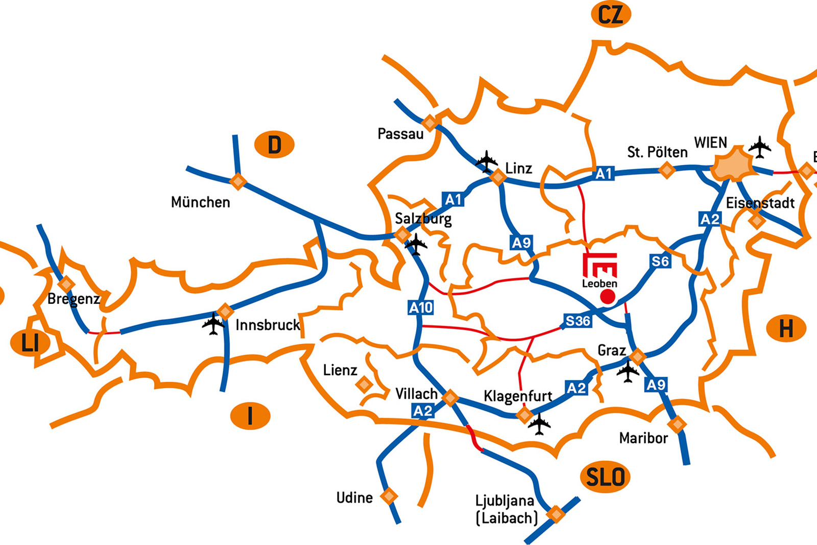
By car:
- Graz: approx. 50 minutes
- Vienna: approx. 90 minutes
- From motorway exits Leoben West or Leoben Ost: approx. 10 minutes to the city centre
By train & bus:
The railway hub in Leoben is well connected to international and national railway destinations. There are different bus lines for transportation within the municipal area of Leoben and to the adjacent municipalities.
From the railway station, it is only a 10-minute walk or a short bus or taxi ride to the city centre.
More on this subject:
By plane:
The closest airports are
- Graz Airport – approx. 70 kilometres
- Klagenfurt Airport – approx. 140 kilometres
- Vienna Airport – approx. 170 kilometres
Car parking in the city centre
Car parks:
Leoben offers several car parks and garages in the city centre available for short-term parkers:
- Underground car park at Leoben Main Square/Hauptplatz – central location, directly connected to the main square and Leoben Congress
- Multi-storey car park at LCS – parking area of LCS Leoben City Shopping Centre, with access to the main square
- Asia Spa car park – car park at Asia Spa and Leoben Ice Rink, only a short walk from the University of Leoben
More on this subject: Car Parks in Leoben
Parking zones in the city centre:
You will find two types of parking zones in the city centre of Leoben, both subject to charge: the Blue Zone and the Green Zone.
More on this subject: Parking Fees and Parking Zones in Leoben
Bus parking in the city centre
There are several options for tour buses to stop and park near the city centre:
Stops for drop-off and pick-up (no parking):
- Otto Glöckel-Straße
- Parkstraße
Parking for longer periods of time:
- Parking bay in Kärntner Straße (B 116)