Outdoor Sports
On this page:
In and around Leoben, sports and outdoor fans will find a wide range of activities amidst the Upper Styrian mountain world.
Walking & running
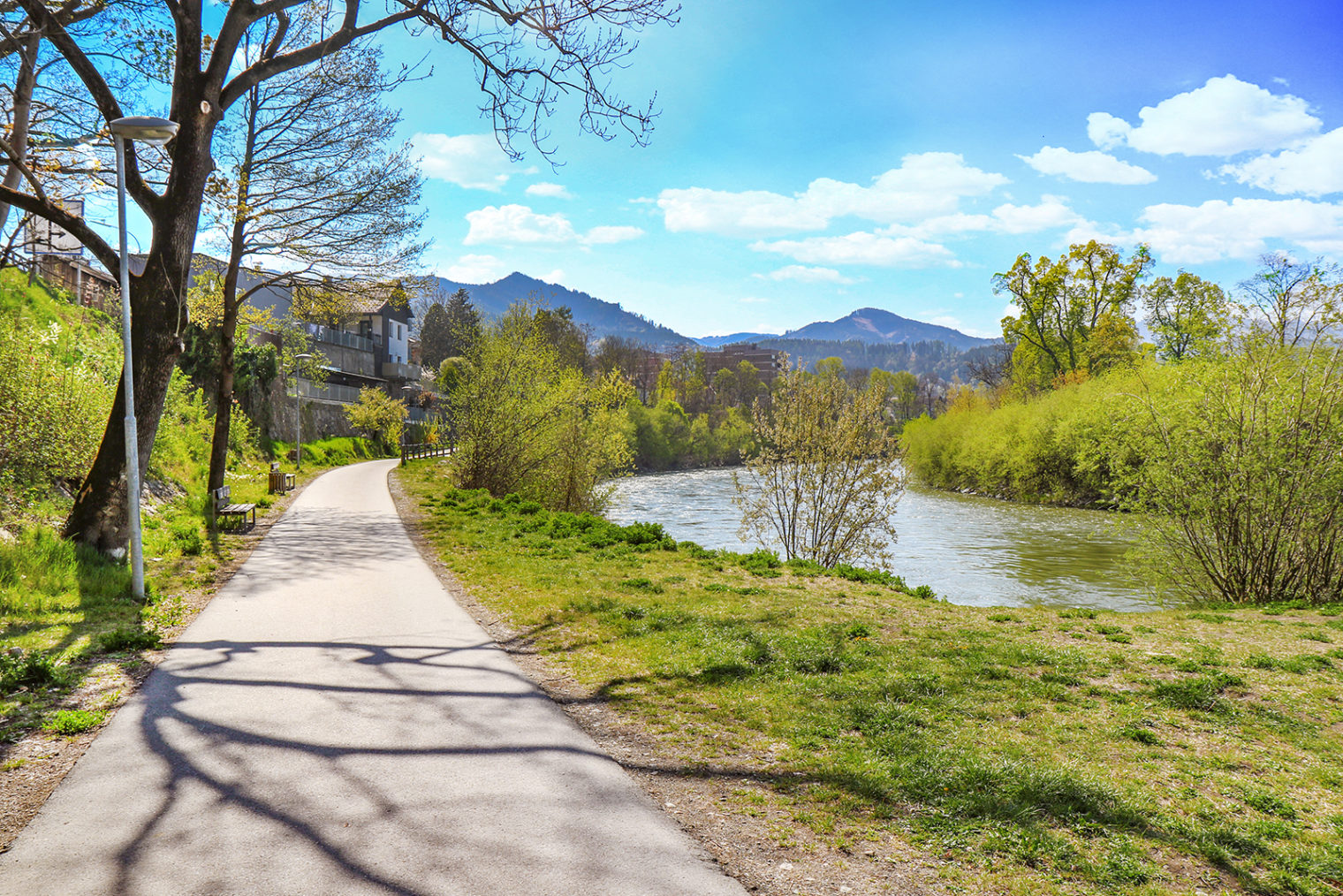
Footpath and cycle path in Leoben; photo: BüKo
In Leoben, you have around 35 kilometres of marked running and walking trails at your feet.
You can choose between seven different circuits, ranging from just under three to more than six kilometres in length. Two additional trails lead towards Niklasdorf.
All trails are marked in colour and with signs along the route. There are also connecting pathways linking the trails.
Show on city map
Hiking
Hiking on Maßenburg Leoben; photo: Freisinger
Hiking enthusiasts will find many tours with different degrees of difficulty in and around Leoben: You can, for example, take a leisurely hike over the Kalvarienberg hill, or a more challenging one to the Mugel.
Information boards at the access points indicate the hiking trails. Leoben Tourist Office, located on the main square, provides you with maps of the local hiking trails.
Show on city map:
Discover more:
Cycling & mountain biking
Cycling in the city centre; photo: Freisinger
Cycling
Leoben is the starting point for many attractive cycling tours. In addition, the town lies directly on the River Mur Cycling Path and the Iron Road Cycling Path.
Click below for a selection of bicycle tours:
About eight kilometres of the popular “R2” River Mur Cycling Path (“Mur-Radweg”) run through Leoben. The many sights along its path make it a memorable and remarkable cycling tour. It follows the course of the river Mur from its origins in Salzburg to Croatia, where it flows into the Drava.
More on this subject: The River Mur Cycling Path at a glance
The “R38” Iron Road Cycling Path (“Eisenstraßen-Radweg“) runs from Leoben via Trofaiach to Hieflau. The leg to Vordernberg has a distance of 17 kilometres. On your way along the Styrian Iron Road, you will see several old blast furnaces and even historic waterwheel-driven blast furnaces. The many inns along the cycle path provide ample opportunities to take a break, perhaps even longer than initially planned.
More on this subject: Iron Road Cycling Path tour description
The cycling path from Leoben to Bruck and back (“Leoben, Bruck und z’ruck”) first leads you from Leoben Main Square towards Niklasdorf. Following the old main road, you will then reach the main square of Bruck an der Mur, an ideal place for a rest. On your way back, you will follow the river Mur, cycle through Köllach and end your tour in Leoben. The distance is approximately 35 kilometres, and the duration around 3 hours.
More on this subject: Leoben, Bruck and back tour description
There are currently around 30 kilometres of cycling paths available in the urban area of Leoben, most of which have their own footpath or cycle lane
More on this subject: Cycling Paths in Leoben
Mountainbike-Strecken
The 5.5-kilometre trail starts on the Leoben side of Mt. Mugel, runs through the Kleiner Gößgraben to the Trasattel parking area, and then up to the Mugel. You can cycle back to Leoben through the municipal area of Niklasdorf. Cycling along this trail is permitted from 1 May to 15 October from 7:00 to 18:00 (or until 17:00 from mid-September to mid-October).
More on this subject: Mugel trail map
The trail leads from the Seegraben district via Veitsbergweg, Sonnensiedlung, Prentgraben, Dorfstraße and Veitsberg into the Laintal valley. You may cycle along this trail from 1 May to 15 October from 7:00 to 18:00 (or until 17:00 from mid-September to mid-October).
More on this subject: Laintal valley trail map
Difficulty: medium
Length: 11,7 km
Altitude metres: 790 metres of altitude
You may cycle along this trail from 1 May to 15 October from 7:00 to 18:00 (or until 17:00 from mid-September to mid-October).
More on this subject: Laintal valley trail map
Difficulty: medium
Length: 11,4 km
Altitude metres: 800 metres of altitude
You may cycle along this trail from 1 May to 15 October from 7:00 to 18:00 (or until 17:00 from mid-September to mid-October).
Difficulty: medium
Length: 5,5 km
Altitude metres: 400 metres of altitude
You may cycle along this trail from 1 May to 15 October from 7:00 to 18:00 (or until 17:00 from mid-September to mid-October).
Difficulty: medium
Length: 6,0 km
Altitude metres: 260 metres of altitude
Show on city map:
Other MBT trails in the region:
Pump track & Calisthenics
Pump track
Located at the Leoben-Hinterberg bike route, the facility offers a 37-metre kid’s track and a 119-metre course with waves and banked turns on 1,400 sqm. You can ride the track with anything that rolls – from bicycles to skateboard to scooters and inline skates.
Adress:
Cycling path Leoben-Hinterberg, near the former Hinterberg railway station
Fabriksgasse/ Am Wirtschaftspark
8700 Leoben
show on city map
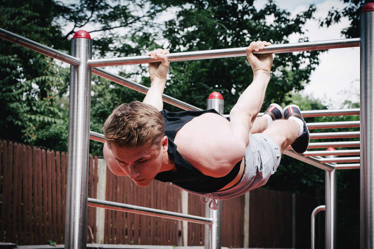
Calisthenics training area
There is a 120 sqm outdoor gym on Mareckkai between Hans Klöpfer-Gasse and Alois Edlinger-Gasse with bodyweight training equipment.
Calisthenics park on Mareckkai; photo: Foto Freisinger
Adress:
Mareckkai
(between Hans Klöpfer-Gasse/ Alois Edlinger-Gasse)
8700 Leoben
show on city map
Climbing
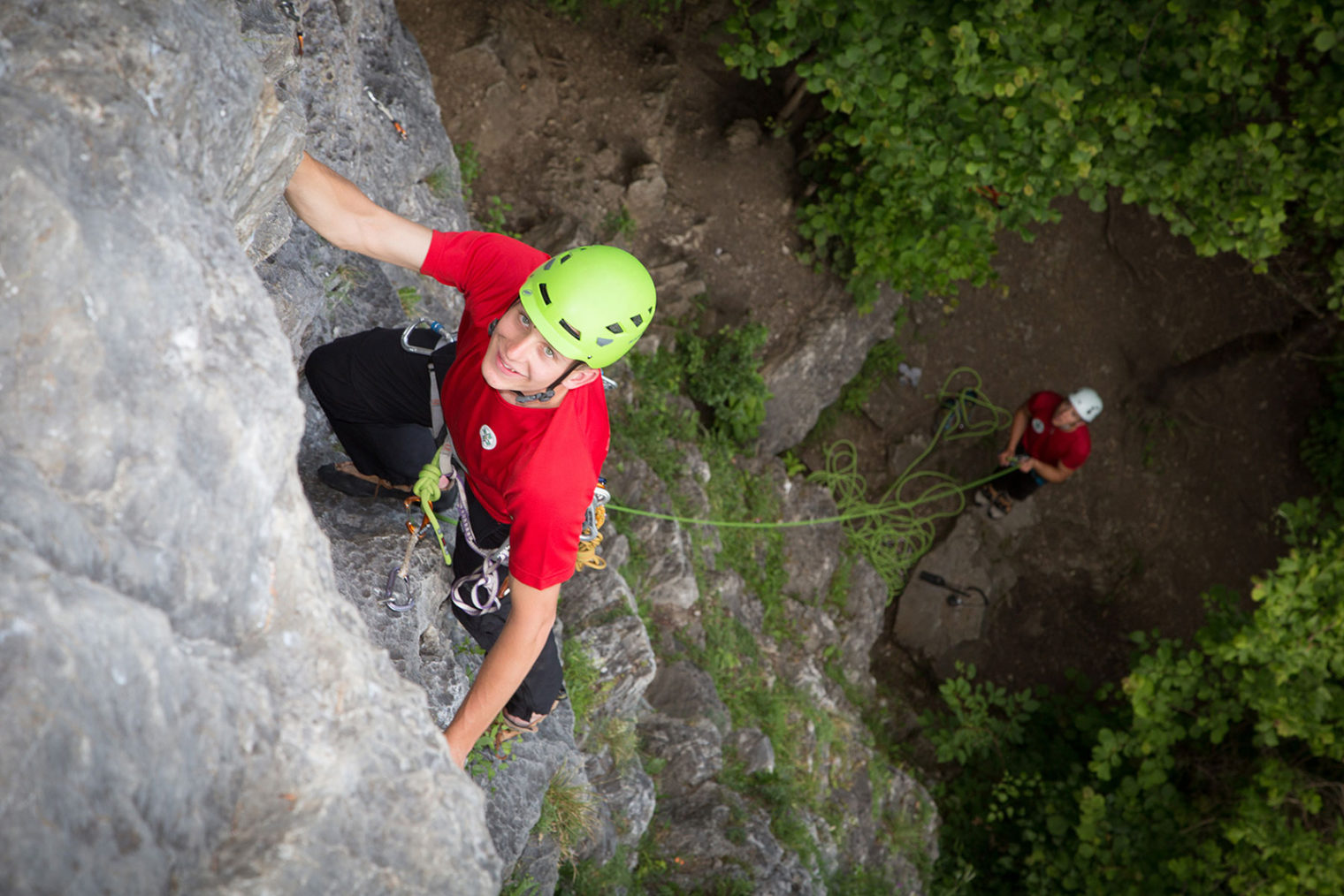
Climbing in Leoben-Hinterberg; photo: Freisinger
Experienced climbers can test their skills on the Lesner Wand on Mt. Häuselberg. In good weather conditions, Lesner Wand is accessible all year round. The point of departure is the Häuselberg parking area.
More information:
Alpine Association Leoben
Waasenplatz 5-6
8700 Leoben
+43 3842 431 43
leoben@sektion.alpenverein.at
Website Austrian Alpine Association – Leoben Section
Other climbing facilities in Leoben:
Water sports on the river Mur
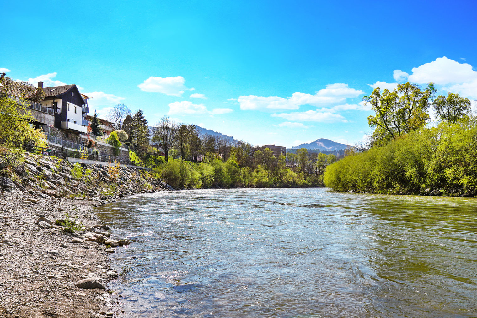
Town by the river; photo: BüKo
The centre of Leoben is located inside a loop of the river Mur. The LE Boathouse (“LE Bootshaus”) offers stand-up-paddling, rafting and other activities on the river Mur.
Contact:
LE Boathouse – Flußwandern
Bahnhofplatz/ below Restaurant Coretto
8700 Leoben
+43 664 88 33 29 30
office@flusswandern-mur.at
Website LE Boathouse
Cross-country skiing
Leoben has its own five-kilometre cross-country skiing trail in the Schladnitzgraben. This family friendly trail is also ideal for beginners.
More information:
Gasthaus Schager
Schladnitzgraben 2f
8700 Leoben
+43 3842 261 75
tennisschuleschager@aon.at
Website Gasthaus Schager
Other cross-country skiing trails in the region:
Skiing
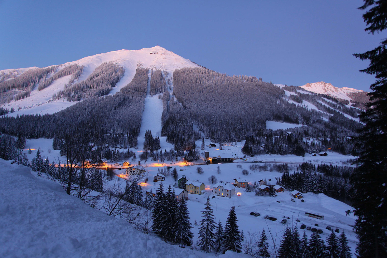
The Präbichl ski resort near Leoben; photo: Foto Freisinger
The Präbichl ski resort is situated only about 20 kilometres from Leoben.
Contact:
Präbichl Bergbahnen GmbH
Weidauweg 18
8794 Vordernberg
+43 3849 6060-0
office@praebichl.at
Website Präbichl